
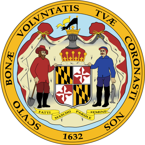

Maryland State Authority
Maryland State Authority is home to 6,206,011 residents with median household income $103,678.
Explore Maryland State Authority by County
Click any county to visit its landing page.
Maryland State: What It Is and Why It Matters
Maryland is a small state with an outsized footprint — 32nd in land area, yet home to more than 6.1 million residents (U.S. Census Bureau, 2020 Decennial Census), a federal research corridor anchoring the national capital region, and a tidal estuary that shapes environmental policy for the entire Atlantic seaboard. This page maps the structure of Maryland's government, explains how its 23 counties and Baltimore City function within that structure, defines the geographic and jurisdictional scope of this authority, and points toward the 87 detailed pages on this site covering everything from individual counties to state agencies, regional policy, and constitutional history.
How This Connects to the Broader Framework
Maryland does not exist in isolation from the national picture. The state sits within a broader reference network anchored by United States Authority, which covers federal government structure, national policy frameworks, and cross-state comparisons. Maryland's particular complexity — its deep entanglement with federal agencies, its shared governance of the Chesapeake Bay with Virginia and the federal government, and its role as home to agencies like the National Institutes of Health in Bethesda and the Social Security Administration in Woodlawn — makes it a useful case study in what it actually means to be a state neighbor to the federal government.
For a granular look at how Maryland's state government is organized, how its agencies operate, and how Annapolis relates to Washington, Maryland Government Authority provides detailed reference coverage of state institutions, legislative processes, executive branch departments, and the constitutional framework that governs them. It is the natural companion to the geographic and demographic depth covered here.
Scope and Definition
Maryland occupies 12,407 square miles of the mid-Atlantic region, bordered by Pennsylvania to the north, Virginia and West Virginia to the south and west, Delaware and the Atlantic Ocean to the east, and the District of Columbia at its approximate geographic center — an arrangement that gives the state its famously irregular shape and earns it the nickname "America's miniature."
The state's political geography divides into 23 counties and one independent city. Baltimore City is constitutionally separate from Baltimore County — a distinction that confuses nearly everyone encountering it for the first time and has real administrative consequences, since the two jurisdictions have distinct governments, tax bases, school systems, and police departments. The counties range enormously in character: Allegany County in the western Appalachian mountains shares almost nothing ecologically or economically with Anne Arundel County on the Chesapeake Bay's western shore, or with Carroll County in the rolling piedmont north of Baltimore.
Maryland operates under a constitution originally ratified in 1867, which has been amended more than 200 times (Maryland State Archives). The General Assembly meets in 90-day sessions beginning in January, and the Governor holds executive authority under Article II of that constitution.
What falls outside this scope: Federal law, federal agency operations within Maryland's borders, interstate compacts except as they affect Maryland governance, and the laws of neighboring states — Delaware, Pennsylvania, Virginia, West Virginia, and the District of Columbia — are not covered here. Readers researching federal facilities in Maryland, such as Joint Base Andrews or the National Security Agency at Fort Meade, should consult federal sources. Municipal home rule charters in cities like Annapolis, Rockville, and Gaithersburg operate under state-granted authority but involve layers of local law not fully addressed at this level.
Why This Matters Operationally
Maryland's density of regulated activity is unusual even among mid-Atlantic states. The Chesapeake Bay Critical Area law — Natural Resources Article, Title 8, Subtitle 18 of the Maryland Code (Maryland General Assembly) — applies a 1,000-foot buffer zone around the bay and its tributaries, directly affecting land use, construction, and environmental permitting in 16 of the state's 24 jurisdictions. That is not a minor regulatory footnote; it shapes where housing gets built, how stormwater is managed, and which agricultural practices are permissible across roughly half the state's settled landscape.
The state's fiscal structure also produces real-world consequences at the county level. Maryland counties receive significant funding through a formula-driven education aid system, and the gap between property-wealthy jurisdictions like Baltimore County and property-constrained ones like Caroline County can run to thousands of dollars per pupil in effective local contribution — a disparity that drives persistent policy debate in Annapolis.
Understanding how the state works is, in other words, prerequisite to understanding why specific services, regulations, and public institutions function the way they do in any particular zip code.
What the System Includes
This site covers Maryland's government, geography, demographics, and public institutions across four broad categories:
-
Geographic units — all 23 counties, Baltimore City, and the state's major municipalities, including Calvert County, reviewed for government structure, demographics, and public services.
-
State institutions — the General Assembly, Governor's Office, judiciary, constitutional officers (Comptroller, Attorney General, Treasurer), and principal departments including Health, Education, Transportation, Environment, Labor, and Commerce.
-
Regional frameworks — Western Maryland, Central Maryland, Southern Maryland, the Eastern Shore, and the Capital Region, each treated as a distinct geographic and economic context.
-
Cross-cutting policy areas — state taxes, public education, higher education, healthcare policy, criminal justice, environmental regulation, housing, economic development, elections, and the state's relationship with the federal government.
The Maryland State: Frequently Asked Questions page addresses the most common points of confusion about jurisdictional boundaries, government structure, and how state and county authority interact. For readers tracking down something specific about a particular place or institution, the site's 87 pages cover enough ground that the answer is likely one link away — whether the question is about the government of Anne Arundel County, the geographic character of Allegany County, or the administrative relationship between a town in Carroll County and the state government in Annapolis.
Maryland Counties — Interactive Map
Click any county to view its full reference page.
Maryland county map
Browse Counties
- Baltimore city (577,193)
- Howard County (27,552)
- Montgomery County (18,976)
- Charles County (14,792)
- Harford County (13,397)
- Baltimore County (8,564)
- Anne Arundel County (8,297)
- Prince George's County (8,108)
- Frederick County (7,994)
- Carroll County (6,311)
- Worcester County (5,161)
- Queen Anne's County (4,725)
- Calvert County (2,769)
- Cecil County (2,756)
- Garrett County (2,033)
- St. Mary's County (1,521)
- Talbot County (724)
- Kent County (465)
- Washington County (267)
- Caroline County (148)
All Counties
Top Employers — Statewide
Data from state economic-development agency. Source: https://www.annapolis.gov/1276/Top-Employers
-
State government services
-
County government services
-
Federal naval education facility
-
City government services
-
Hotel and Pusser’s Caribbean Grille
-
Education – 4 year college
-
Restaurant
-
Telecommunications contractor
-
Restaurant and catering
-
Skilled nursing and rehabilitation therapy provider
-
Fast food
-
Grocery store
-
Hotel
-
Real Estate
-
Nonprofit
-
Restaurant & Brew Pub
-
Car sales
-
Grocery store
-
Banking
-
Department store
Federal Disaster Declarations (23)
Source: FEMA OpenFEMA v2 DisasterDeclarationsSummaries
Codes & laws coverage
State statutes & administrative code
10 / 10
categories with corpus rows (100% of applicable) · known: Agency Guidance, Attorney General Opinions, Constitution & Foundation, Court Decisions, Federal Notices & Orders (+5 more) · full breakdown →
Laws & Codes
Live from our ingestion pipeline; new content appears within minutes of fetch.
- Md. Const. art. XX · source
- Md. Const. art. XIX, § 2 Not adjacent to or within one-quarter mile of property that is: · source
- Md. Const. art. XIX, § 1 Located: · source
- Md. Const. art. XVIII · source
- Md. Const. art. XVII · source
- Md. Const. art. XVI, § 1 (a) The people reserve to themselves power known as The Referendum, by petition to have submitted to the registered voters of the State, to · source
- Md. Const. art. XV, § 1 Every person holding any office created by, or existing under the Constitution, or Laws of the State, or holding any appointment under any C · source
- Md. Const. art. XIV, § 1 The General Assembly may propose Amendments to this Constitution; provided that each Amendment shall be embraced in a separate bill, embodyi · source
- Md. Const. art. XIII, § 1 The General Assembly may provide, by Law, for organizing new Counties, locating and removing county seats, and changing county lines; but no · source
- Md. Const. art. XII, § 1 The Governor, the Comptroller of the Treasury and the Treasurer, shall constitute the Board of Public Works in this State. They shall keep a · source